 The (Lepape) Marmotte Alpes is another Granfondo on many cyclists’ bucket list.
I’ve been considering participating several times.
But like for the Maratona dles Dolomites, it’s hard to get a ticket for.
When registration opens, you’d better be ready, as the available spots – 7,000 – are gone within hours.
Otherwise, you’ll need to sign up for an all-inclusive package with a ‘Marmotte Tour Operator’.
That will bring you more but can set you back (up to) thousands of Euros.
The Marmotte Alpes is a one-day Granfondo held at the end of June each year.
The event was first held in 1982, which makes it one of the oldest Granfondo in the world.
It is also one of the most popular amateur cyclist events in Europe.
The Route
The official route of the Marmotte Alpes starts and ends in Le Bourg-d’Oisans.
Or rather: it finishes in and on l’Alpe d’Huez, but you’ll probably descend back to Le Bourg-d’Oisans…
It runs clockwise from the start, passing (through) Allemond, Saint-Étienne-de-Cuines, Saint-Michel-de-Maurienne, Valloire and La Grave.
The total distance is 177 kilometers, traversing 4 cols, for a total of ~5,000 meters of D+
The Marmotte Alpes Cols
The Marmotte Alpes traverses 4 cols:
- Col du Glandon (1,924 m) – 26.6 kms with 1,355 m of D+ from Verney (see Croix de Fer for more info)
The descent to the Maurienne valley is neutralised, to avoid unnecessary risks.
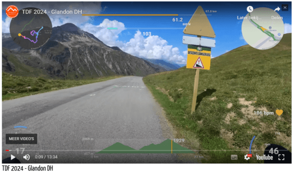
Trust me, this descend, especially the top half, is a menace with twists and turns that are hard to anticipate.
The bottom half is faster, but as there will be traffic, you can’t go all out.
Then there’s a flat-ish 25 kms along the main road between Saint-Étienne-de-Cuines to Saint-Michel-de-Maurienne.
These are not to be underestimated and can wear you out too!
Next:
- Col du Télégraphe (1,566 m) – 11.8 kms with 837 m of D+ (see Col du Galibier for more info)
- Col du Galibier (2,642 m) – 18 kms with 1,221 m of D+ from Valloire
This Marmotte Alpes piece de résistance combo is good for a gruelling 35 kms, with over 2,000 m of D+.
That’s including a short descend – most of it – into Valloire.
The Galibier offers magnificent mountain panoramas as a consolation.
You then descend to the summit of the Lautaret – this can be a cold and windy descend.
After that, it’s another 33 kms (!) mainly downhill to Le Clapier.
There are a few stretches that are not downhill, most noteworthy the 2 kms after Le Freney-d’Oisans.
From Le Clapier, the 5 km straight to the base of the last climb, is your last ‘rest’ of the day.
- Alpe d’Huez (1,846 m) – 13.9 kms with 1,118 m of D+
Adding up the totals for each Marmotte Alpes climb gives you just over 4,500 m of D+ so you pick up around 500 more along the route between the cols…
Practical
The start of the Marmotte Alpes is in waves, the first wave leaving at 7:00 AM, then 7:20 and 7:40.
Inform yourself about the cut-off times, as they vary, even if only by 5 or 10 minutes.
You wouldn’t want to show up at the start of the Alpe 5 minutes late…
There are usually two cut-off points
- at the Galibier summit, probably just after 4:00 PM
- at the foot of the Alpe d’Huez, probably just after 6:00 PM
As the tunnels in the Lautaret descend are not brightly lit, you’ll need bike lights.
In fact, they are mandatory…
Marmotte Alpes, Bike Rebel Style
When we had our Tour de France 2021 base camp along the route, I decided it was now or never.
It was also earlier in the year than back in 2017, when we were in Briançon in September.
While that offered a similar alternative as to what I did in 2021, the days were just too short and cold.
I eventually completed my Marmotte Alpes during stage 11 of the 2021 Tour de France.
As we were staying in Saint-Jean-de-Maurienne, I started and ended at my doorstep.
Yes, that means I didn’t finish on the Alpe d’Huez.
I descended towards Villard-Reculas, so my descend wasn’t a total freebie, as you get to cross the “Pas de la Confession”.
And together with the short uphill sprint into Villard-Reculas, this adds about 100 altimeters to the total.
Which is peanuts, but it more than makes up for the lost altimeters not having to climb up the Allemond dam 😎
I then concluded my Marmotte Alpes version with the climb up the Glandon and a descend to Saint-Jean-de-Maurienne.
Other than in my report, you can find more info on the official Marmotte Alpes pages.
Here’s my Marmotte Alpes route, taken from the Garmin recording:
And pictures taken by Paula during the stage:
Background picture for this page by Louis Legon

